
Llano River flood water surge in Kingsland, LCRA opens flood gates in the Highland Lakes
Connie Swinney/The Highlander
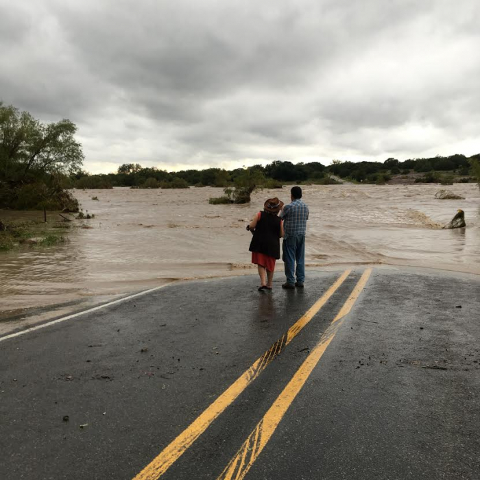
Kingsland residents Ben Salazar and Dianna Hardesty checked out flooding at the Kingsland Slab Tuesday (Oct. 9) as rushing flood waters in the Llano River made their way from the Junction area through the Highland Lakes. Authorities reported no swiftwater rescues or injuries in Llano or Burnet counties.
Connie Swinney •
Staff Writer •
As the surge of the Llano River subsided, Highland Lakes residents and property owners reported minimal damage Oct. 9 and 10 to lakeside structures as well as some rising water along shorelines inching onto property.
Murky floodwaters from the Llano River from the Junction area crested in Kingsland after midnight just 24 hours earlier, eventually making its way through lakes LBJ and Marble Falls – to be captured in Lake Travis, just west of Austin.
On Oct. 10, the Lower Colorado River Authority reported floodgate operations on Wirtz and Starcke dams to pass floodwaters downstream.
“The Llano River at Junction peaked at 12:40 pm Tuesday, Llano River near Mason peaked about 8:30 p.m. Tuesday, andLlano River at Llano peaked at 1:41 a.m. Wednesday,” according to the LCRA Flood Operations Report. “That water began entering Lake LBJ early Wednesday morning and will pass through lakes LBJ and Marble Falls, ultimately to be stored in Lake Travis, which is expected to rise to be within a range of about 665 to 667 feet msl on the next 24 hours.”
As of Oct. 10, one floodgate remained open at Wirtz Dam on Lake LBJ and three floodgates remained open at Starcke which dams Lake Marble Falls.
For much of the waterway swells residents watched and kept property and vehicles free of the waterway, adjacent creeks and stream and low-water crossings.
Ben Salazar of Kingsland was among a number of residents who ventured onto RR 3404 (Slab Road) in Kingsland in Llano County to see the force of the currents, making their way downstream.
“A friend of mine told me about it. I've never seen nothing like today,” he said. “It had already dropped seven to eight feet from last night.”
Dianna Hardesty of Kingsland said, “You want to come look at it. I'm glad the police are here monitoring. The rain is good.
Salazar added he welcomed the wet weather but kept a cautious eye on the swift-moving water.
“No one can think to try to cross,” he said. “It's too powerful.”
Where the storm runoff originated in Kimble County, first responders rescued more than a dozen people at the height of the flood event.
As word of four people still missing in that area since Tuesday rippled across the state, local residents remained well aware of the destructive nature of the swift currents.
“It's terribly sad,” said Kingsland resident Becky Pound. “As awe-inspiring as it is, it can be deadly.”
LCRA reported crews will continue to monitor the Highland Lakes for flood gate operations for the next several days.
The weather forecast in the Highland Lakes remained primarily partly cloudy, less humid and clear throug the weekend of Saturday and Sunday, Oct. 13 and 14. A passing morning shower is predicted for Sunday with less humidity throughout the day and cooler evenings.
In Junction, a brief shower and possible thunderstorm is in the forecast for Junction, Friday and Saturday.
Connie Swinney covers the Marble Falls community, law enforcement, crime, courts and public safety stories. Send her a note at connie@highlandernews.com.