The weather means business this week

Courtesy: National Weather Service
By Emily Hilley-Sierzchula
Just at the time when Central Texas was in danger of entering into a drought yet again, a weather system is set to drop an anticipated 2-4 inches of rain over the region this week. Although plants will be happy with the rain since the region is classified as “abnormally dry” – one step away from “moderate drought,” according to the U.S. Drought Monitor – the system also could bring two rounds of thunderstorms starting Tuesday morning through late in the week, according to forecasts by meteorologists with the National Weather Service (NWS) Austin/San Antonio region, on Monday morning.
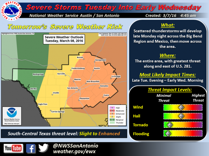
Last week, the weather outlook called for a threat level classified as “slight,” but on Monday morning, March 7, meteorologists elevated the threat to “enhanced,” according to the NWS.
“Strong to severe thunderstorms can be expected Monday evening into early Tuesday,” according to Jon W. Zeitler, of the NWS. A second round of thunderstorms could follow beginning Tuesday evening into early Wednesday.
“The severe threat should end by mid-morning Wednesday,” he added.
Possible threats include “one or two tornadoes, damaging winds of 60-70 mph and hail ranging from pea-sized to golf ball-sized,” Zeitler said.
A large upper low of moist Gulf air will combine with a dry line to produce the two rounds of strong to severe thunderstorms, he said.
Bob Rose, Lower Colorado River Authority (LCRA) meteorologist, said the “very moist atmosphere” creates favorable conditions for “widespread rain showers and thunderstorms on Monday through Tuesday.”
See The Highlander on Tuesday, March 8, for more.

