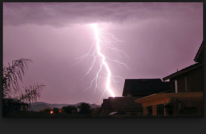
Burnet, Llano and surrounding counties are included in a Hazardous Weather Outlook and Flash Flood Watch from the National Weather Service Austin/San Antonio office for Wednesday, May 18:
This afternoon and tonight: a line of storms should develop across the western areas overnight. The main hazard with this activity is the potential for heavy rainfall. a flash flood watch is in effect beginning at 1 a.m.
Another upper level disturbance approaching from the west will produce widespread 1-3 inch rainfall totals across South Central Texas, said the NWS. Saturated soils and relatively high rivers, streams, and reservoirs due to heavy rainfall over the past five days will cause most of this rain to runoff into area creeks, streams, and low lying areas. Widespread showers and thunderstorms that develop west of the region are expected to move into the Rio Grande Plains and Edwards Plateau after Midnight before progressing east into the Hill Country and I-35 corridor tomorrow morning and Coastal Plains late tomorrow morning. Storms should clear the area from west to east ending by late tomorrow evening in the Coastal Plains to end the flash flood threat.
Although the primary threat will be flash flooding and subsequent river flooding, severe storms capable of producing a few tornadoes, large hail, and damaging winds will be possible for areas located along and south of a frontal boundary. This front is currently expected to move into the Coastal Plains where the threat for severe storms is greatest, but is expected to remain southeast of the I-35 corridor and areas northwest of that where the threat is marginal. Shifts in the location of this front may cause this severe threat to increase or decrease further in area tomorrow.
Moving forward, Thursday, May 19, through Tuesday, May 24: The line of storms will move east across south-central texas during the day on thursday. there is a marginal to slight risk some storms during this time could become severe producing damaging hail and wind gusts. An isolated tornado can not be ruled out, especially in the southeastern counties. The threat for heavy rain will also continue on Thursday. On average, 1-3 inches of rainfall is expected, with localized pockets of 3-4 inches possible. The flash flood watch is in effect through 10 p.m. Thursday.
LCRA Chief Meteorologist Bob Rose discussed the pattern on Tueday May 17: The chance for rain and thunderstorms will increase across the entire region beginning Wednesday night when a large trough of low pressure tracks east out of southern New Mexico. This trough will enhance the overrunning rain pattern across Central and South Texas. Rain showers and thunderstorms look to increase in areal coverage and intensity Wednesday night and continue throughout the day on Thursday. The rain will persist into Thursday evening but should taper off from west to east Thursday night. Rain amounts are forecast to generally total between 1 and 2 inches although the Interstate 35 corridor could see totals to near 3 inches.
Rainfall amounts between this afternoon and Friday morning are forecast to total between 3 and 4 inches across parts of the Hill Country, with totals in excess of 4 inches noted in the area between Fredericksburg and Ozona. Totals of 2-3 inches are forecast at most other locations.
The National Weather Service detailed forcast for Wednesday, May 18 reads:
This Afternoon
A 40 percent chance of showers and thunderstorms. Cloudy, with a high near 71. North northeast wind around 5 mph.
Tonight
Showers and thunderstorms likely, mainly after 7pm. Cloudy, with a low around 62. Northeast wind 5 to 10 mph. Chance of precipitation is 60%. New rainfall amounts between a tenth and quarter of an inch, except higher amounts possible in thunderstorms.
Thursday
Showers and thunderstorms. Some of the storms could produce heavy rainfall. High near 72. East northeast wind 5 to 10 mph. Chance of precipitation is 90%. New rainfall amounts between 1 and 2 inches possible.
Thursday Night
A 30 percent chance of showers and thunderstorms. Mostly cloudy, with a low around 60. North northeast wind around 5 mph.
Friday
Partly sunny, with a high near 81. North wind around 5 mph becoming east in the afternoon.