

Fire Weather Watch issued
The National Weather Service has issued a Fire Weather Watch.
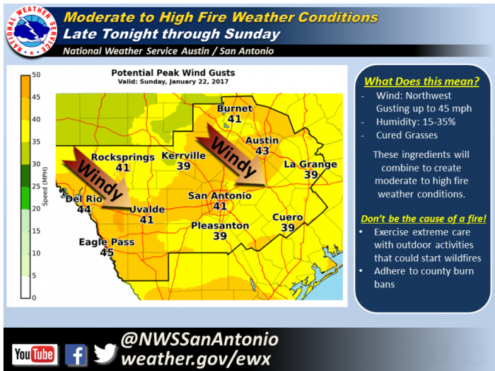
A potent weather system to our north is pushing the strong and gusty northwest winds that began late last night and promise to persist through Sunday afternoon. The strongest winds, with gusts to around 45 mph, will occur during the day on Sunday. Along with the wind, relative humidity will drop below 20% out west near the Rio Grande Sunday afternoon and and below 35% elsewhere. This wind threat alone will be enough to carry fire quickly, especially in wildland grasses that are cured for the winter. A Fire Weather Watch has been issued for all of South Central Texas, and some locations could be upgraded to a Red Flag Warning.
The high wind could also result in hazardous driving conditions for high profile vehicles, displace loose objects, result in minor property damage, and cause isolated power outages.
The NWS forecast for Marble Falls and surrounding area:


