

Slight risk for severe thunderstorms headed this way
Submitted by highlander1 on
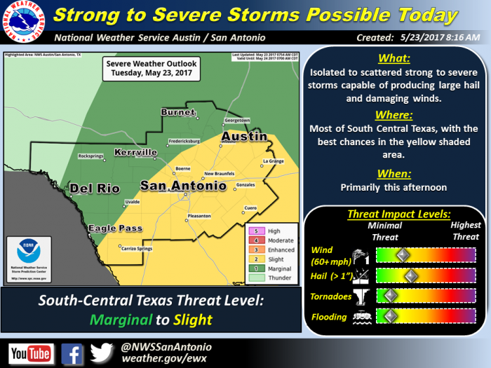
The risk is slight but the National Weather Service warns new bands of storms are headed across most of South Central Texas, including local and western counties, extending to the Austin and San Antonio metro areas.
Worst of the threats are hail up to golf ball size and straight line wind gusts up to 60 mph and worth noting for travelers.
Scattered strong to severe showers and thunderstorms are expected to develop late this morning or early this afternoon in the Hill Country along a cold front before pushing south-southeast across the region into the Austin and San Antonio metro areas around mid-afternoon. The chance of storms becoming severe will increase deeper into the afternoon as storms progress further south. The main threats with these storms will be large hail and straight-line winds gusts. Drier conditions will move in behind the front tonight to limit thunderstorm chances until later this weekend.
Rate this article:


