

Harvey hightailing it from Highland Lakes
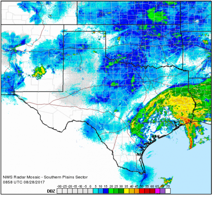
The 5 a.m. radar image shows the worst of the storm moving away. More information can be found at www.weather.gov and more images from the Monday report, on The-Highlander Facebook page.
The Monday morning storm report from the National Weather Service (NWS) shows Burnet and Llano counties high and dry and a reprieve from more heavy rainfall for neighbors just to the south.
The local forecast includes a 50 percent chance of showers and gusty winds remains, improving throughout the week . Dangers for travel to the hardest hit areas remains, however.
The NWS 5 a.m. Monday, Aug.28 storm report says: Tropical Storm Harvey continues a slow drift back to the southeast and will continue southeast and emerge just offshore of the middle Texas coast Monday afternoon.
Harvey is then forecast to make a loop and come back onshore into Southeast Texas Tuesday into Wednesday as a Tropical Storm. Increased confidence in a more easterly forecast track has caused expected rainfall amounts to continue to decrease across South Central Texas. Nevertheless, some moderate to isolated heavy pockets of rainfall will be possible through Monday over our easternmost counties that have already received over 20 inches of rain. Occasional wind gusts around 30-45 mph will continue through the morning in the Tropical Storm Warning counties with 20-30 mph gusts elsewhere.
Key Points:
- A life-threatening flooding event is ongoing east of I-35 corridor including Bastrop, Caldwell, Lee, Fayette, DeWitt, Gonzales, and Lavaca Counties but rainfall rates and totals should continue to decrease.
- Since Friday morning, widespread observed rainfall totals of over 20 inches have occurred east of I-35 and near and north of I-10. Isolated totals as high as 30 inches have been measured in Fayette county.
- Additional rainfall amounts of 1-4 inches are possible east of I-35 and I-37 through Wednesday with isolated higher totals up to 6 inches possible.
- Up to an inch is possible for Austin metro through Wednesday evening.
- Less than an inch is expected in San Antonio metro through Wednesday evening.
- Devastating mainstem river flooding lasting many days is ongoing for the Colorado River Basin, specifically near La Grange. Major flooding is forecast as well for Bastrop and Smithville along the Colorado.
- Major flooding still possible for the Guadalupe river basin.
- 30-45 mph wind gusts within the Tropical Storm Warning through Monday morning.
Local forecast:


