

Caution advised for southern travel
The National Weather Service is continuing its travel advisory just south of the Highland Lakes for in this New Year's Day communique.
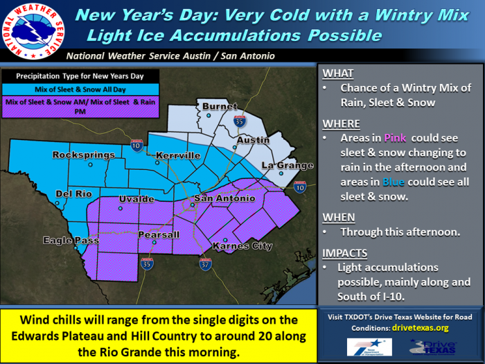
...Light Wintry Precipitation Continues Today...
...Prolonged sub-freezing temperatures for much of the area through Wednesday morning...
Area of Concern:
Wintry Precipitation: Rio Grande Plains, Southern Edwards Plateau, portions of the I-35 corridor generally south of New Braunfels
Sub-Freezing Temperatures: All of south central Texas.
Threats & Impacts:
Expected Accumulations: Accumulations of sleet should remain below one-tenth of an inch and primarily confined to areas west of I-10 and I-35. Little or no snow accumulation expected.
Impacts: Elevated roadways such as bridges and overpasses may become slick and dangerous.
A hard freeze will have a significant impact on sensitive plants and pets. Exposed water pipes could break.
Timing and Overview:
Cold temperatures with many areas remaining below freezing through tonight. Light wintry precipitation, mainly in the form of sleet, will continue through early this evening. Any freezing precipitation should end after 6 p.m. However, sub-freezing temperatures will continue.
Confidence:
Sub-freezing temperatures: High
Light wintry precipitation: Moderate-High.


