
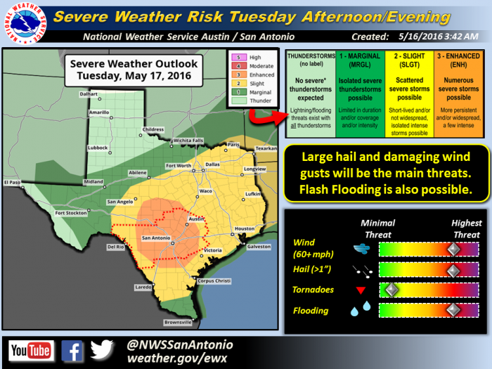
Severe thunderstorms expected across South-Central Texas Tuesday afternoon, evening
Area of Concern:
All of south-central Texas, especially the Hill Country and I-35 corridor.
Threats & Impacts:
Tornadoes: Low threat for tornadoes.
Winds: Wind gusts to 60 MPH.
Hail: Up to 2 inches in diameter.
Rainfall: Localized amounts near 2 inches.
Timing and Overview:
Daytime heating along with an approaching cold front will combine to produce scattered thunderstorms across south central Texas during the afternoon and evening hours. Thunderstorm activity should first develop along the Rio Grande into the Hill Country between 4 and 6 PM. A complex of storms is then expected to move into the I-35 corridor between 7 and 9 PM, with this activity shifting east of I-35 after 10 PM. Large hail and damaging winds are the main severe weather concerns.
Isolated flash flooding can also be expected due to recent rainfall and saturated soils. (Please see the attached graphic for rainfall totals over the past 5 days.)
Confidence:
Hail: Moderate
Winds: Moderate
Rainfall: Moderate to High
Tornadoes: Low